
Walk the Seal Beach Street Directory
An address-based lookup works best as a chain of keys rather than a single name search. The Seal Beach street directory starts with the exact house number and street spelling. The tax system can turn that address into a parcel or account. GIS can then show the parcel beside the street, while the assessor record adds ownership and mailing context where available. RecorderWorks is reached through a party name or document reference, not a street wildcard. Voter tools confirm an authenticated registrant or support an approved data request, not an open list of people on a block. Historical reverse directories can add a named householder for a particular publication year, but their coverage must be checked.
- Enter the exact situs address in the Orange County tax search. Record the standardized address, parcel number, and tax account or default number returned.
- Open that address or APN in OC Land Insights or the Associated Documents Map. Zoom until parcel outlines display, then click the subject parcel and the parcels touching it.
- Use the APN with the Orange County Assessor gateway, ParcelQuest route, or public counter. Record the assessee, mailing destination, values, characteristics, and exemptions only when those fields are releasable.
- Search the current party in RecorderWorks. Open the document reference, inspect the grantor and grantee roles, and follow the prior grantor when a backward ownership trail is needed.
- Use the voter route only for an authenticated personal lookup or an approved authorized request. Then ask the local library about a reverse or criss-cross directory for the specific historical year.
The result is a Seal Beach address trail, not a claim that every person at an address has been identified. Keep the APN, legal description, date, and source for each step. Those details prevent a tax mailing address, a deed party, a permit applicant, and an occupant from being treated as the same person.
Seal Beach Street Directory Records
Seal Beach address records are split by what each custodian knows. The Seal Beach street directory is strongest when its address chain is paired with the right keeper. Orange County holds the assessment roll, tax accounts, deeds, maps, and election records. Seal Beach holds permits, planning files, code material, agendas, and other municipal records. A library can add older address-to-name sources, while Orange County Archives supplies a deeper land-record fallback. The table separates the useful key from the conclusion that the record can actually support.
| Address-Keyed Source | Key or Search Route | What It Can Show | What It Cannot Establish |
|---|---|---|---|
| OC Tax Search | Property address, APN, or tax number | Parcel, tax account, bill status, and a mailing clue | A complete list of occupants or proof that an owner lives at the situs |
| Orange County Assessor | APN, property address, counter inquiry | Assessee, APN, situs and mailing context, values, characteristics, and public exemptions | Household members or an unrestricted owner-name web roster |
| OC Public Works maps | City, document type, date, or map click | Parcel adjacency, APN, legal, tract, survey, annexation, and right-of-way geography | A resident name directly from parcel geometry |
| RecorderWorks | Party name, document number, book/page, type, date, or map | Conveyances, liens, maps, recording dates, and linked grantor/grantee parties | A street-address search or proof of current occupancy |
| Seal Beach permits and planning | Address, APN, project term, or defined request | Construction, planning, inspection, and some owner, applicant, or contractor facts | A complete resident roster; complaint and personal fields may be redacted |
| OC Vote | Authenticated personal tool or approved data request | Registration and residence fields under authorized access rules | Open street browsing or a public list of how anyone voted |
| Reverse directory | Address and publication year | The householder or business listed for that edition | Completeness, current accuracy, or an unverified Seal Beach year run |
An address search becomes stronger when two custodians agree on the parcel and date. It becomes weaker when a Seal Beach street directory result is copied without its key. A recorded deed can show a transfer, a tax record can show a mailing destination, and a permit can show an applicant, yet none alone proves who occupied the address. County offices are in Santa Ana, so a Seal Beach lookup often moves from a city screen to an Orange County counter or archive.
Assessor Fields for Seal Beach Addresses
The Orange County Assessor uses the parcel number as the dependable public web key for a Seal Beach street directory search. The Secured Property Value screen accepts an APN made of eight numeric digits and omits the owner name from the result. Its data reflect an annual assessment-roll snapshot, so later changes may not appear. The official gateway can route researchers to ParcelQuest, but the county does not promise a free, unrestricted owner-name search there. For broader or more current property characteristics, the Public Service Counter is at 500 S. Main Street, 2nd Floor, Orange, open Monday through Friday from 8:00 a.m. to 5:00 p.m.; the published Assessor phone is 714-834-2727.
| System | Field or Control | Type | Required | Format or Access Note |
|---|---|---|---|---|
| Assessor | APN | Text or numeric | Yes on free screen | Exactly eight digits; an assessment key, not an address or owner-name field |
| Assessor | Property address | Address text | One search key where offered | Physical situs; verify the Seal Beach city designation |
| Assessor | Owner or assessee name | Availability varies | No | The official gateway does not promise an unrestricted web name search; use the counter or a scoped request when lawful |
| Assessor | Map or parcel map | Linked map | No | Parcel outlines and map sheets are separate from assessment ownership information |
| Assessor | Submit | Button | Action | Returns secured property value information |
| Tax Search | Search by Property Address | Address text | One of three | Secured or supplemental property tax bills |
| Tax Search | Parcel Number (APN) | Text | One of three | Uses the same parcel key found on maps and tax material |
| Tax Search | Tax Default Number | Text | One of three | Defaulted secured property route |
| Tax Search | Tax Collector Reference Number | Text | One of three | Unsecured property route |
| Tax Search | Tax Year and Assessment Number | Paired text or select | One of three | Unsecured property search pair |
| Tax Search | Business Name | Text | One of three | Unsecured property route |
| Tax Search | View Property Info and Pay Now | Button | Action | Opens property information and payment path when available |
Orange County APNs are often printed in grouped form such as NNN-NN-NNN, while the free value screen asks for eight digits. Copy the form shown on the tax bill or map rather than changing it by guesswork. The Assessor also warns that assessment information can be confidential in part, so a counter visit or records request does not guarantee release of every field.
Seal Beach Street Directory Tax Search
The tax-bill route is the most direct address-keyed web path for a Seal Beach street lookup. Its secured and supplemental side accepts a property address, APN, or Tax Default Number. The unsecured side accepts a Tax Collector Reference Number, a tax year with an assessment number, or a business name. The action is labeled “View Property Info and Pay Now,” but the account is still a tax record rather than a resident list. A bill can show a parcel, balance or status, and a destination for correspondence. That destination may belong to a trust, management office, post-office box, or another address.
The Orange County Treasurer-Tax Collector search shows the address and APN entry paths used for a Seal Beach street lookup.
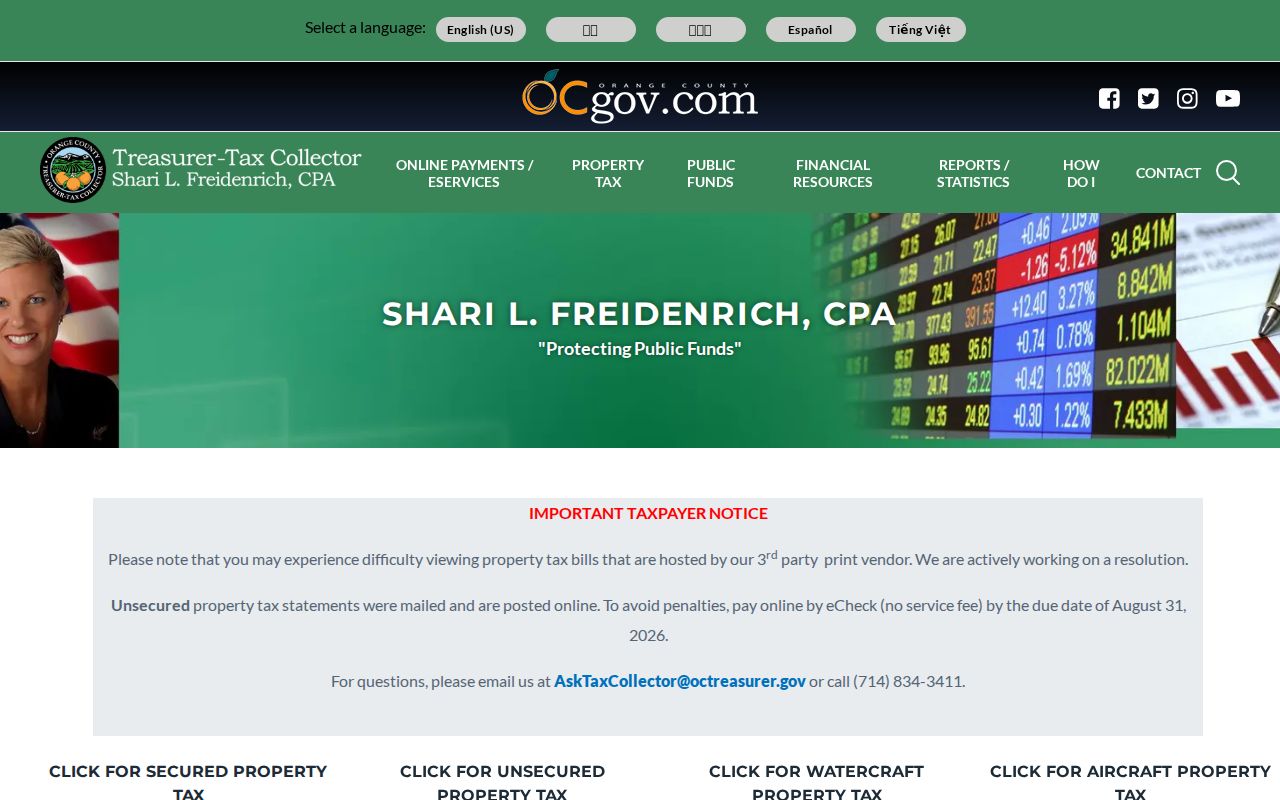
That screen is a tax-account doorway, not a resident list; a returned record still needs an APN and deed cross-check.
The portal may close during fiscal-year processing. An unavailable payment screen is therefore not proof that the parcel has no record. For a question about a current owner or parcel characteristic, compare the tax result with the Assessor route and the recorded-document index. The Treasurer-Tax Collector publishes AskTaxCollector@octreasurer.gov and 714-834-3411 for procedural questions.
Read the Seal Beach Street Directory Map
OC Public Works and OC Survey supply the map layer that lets a researcher walk a street without treating the map as a people database. Enter or zoom to an address, turn on parcels, and click the subject polygon. Then click the polygons that touch it, sit across the road, or lie behind it. Copy every APN and legal label before moving to the tax or deed system. The map can show tract, parcel, survey, annexation, flood, and right-of-way context, but ownership and resident names belong to the record keeper.
The OC Land Insights parcel viewer is the visual bridge from a Seal Beach address to the APN.
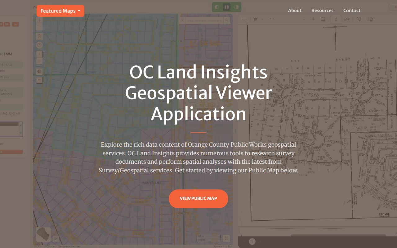
Parcel outlines make a street-by-street pass possible, while the APN keeps each click tied to the county record rather than to an assumption about a household.
The Associated Documents Map adds survey and map context. Choose Seal Beach, narrow by document family or dates, and use labels for APN, legal description, parcel address, parcel number, or road right-of-way dimensions.
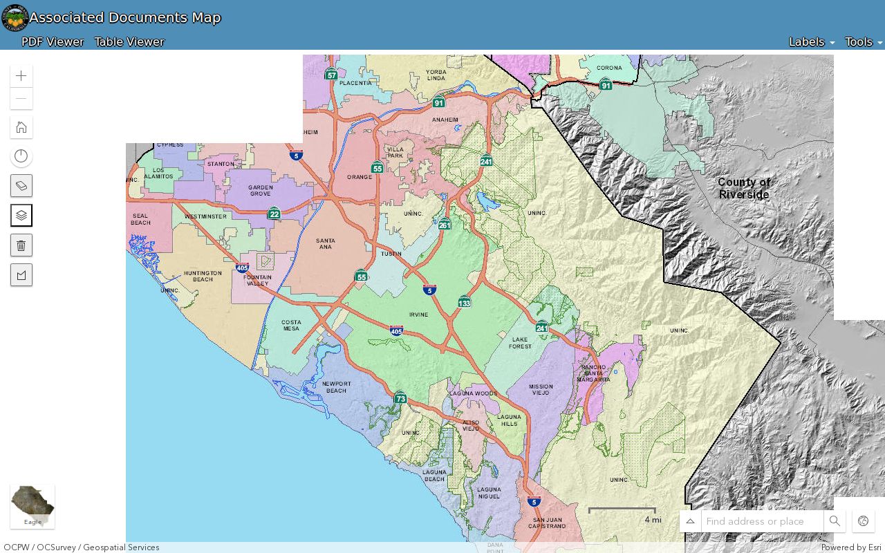
Its Draw and Measure, Time Filter, and map navigation tools help define a block or inspect a recorded map. The parcel service has a 1,000-record maximum and displays parcels at scales of 1:16,000 or closer, so block browsing is more dependable than assuming a citywide export.
Seal Beach Address Keys Explained
Address terms are easy to blur together. In Seal Beach, each one points to a different record system. Keeping the terms separate is especially important when a street label, mailing locality, and deed description do not match.
- Parcel
- A mapped unit of land identified by an APN. A parcel can hold a structure, a common-interest unit, a business use, or no ordinary residence.
- Situs address
- The physical location used by the assessor, tax, permit, and GIS systems. It answers where the parcel lies.
- Mailing address
- The destination for tax or assessment correspondence. It can differ from the situs and may be outside Seal Beach or use a post-office box.
- Legal description
- The recorded land identity, such as a tract, lot and block, parcel map, or metes-and-bounds description. It helps bridge street-label changes.
- Plat
- A recorded map that lays out lots, blocks, streets, or rights of way. Tract and parcel maps supply the geography behind a legal description.
- Criss-cross directory
- A reverse directory that turns an address into the householder or business listed for a particular edition. It may lag a move and omit many people.
Ordinary Seal Beach mailing addresses do not use one quadrant system. Old Town has a recognizable numbered-street and named east-west grid, while subdivision roads curve and gated communities use internal unit or colony patterns. A grouped APN is a useful bridge, but it is an assessment identifier, not a legal boundary or proof of title.
Seal Beach Street Directory and 1982
RecorderWorks is Orange County’s free grantor-grantee index for property documents from 1982 to the present. It is a name-centered index, not an address search and not a document-image service. A person search uses the name in last-name-first format, a grantor or grantee role, optional partial matching, date limits, and document types. The result can expose a document number, type, recording date, book/page or instrument reference, and party links. A grantor conveys an interest; a grantee receives it. Those roles make the index useful for following a deed chain along a street.
| System | Field or Control | Type | Required | Format or Options |
|---|---|---|---|---|
| RecorderWorks | Name tab | Tab | Search mode | Search by person or business |
| RecorderWorks | Name-role selector | Dropdown | For name search | Grantor or grantee role |
| RecorderWorks | Person or business name | Text | Yes for name mode | LAST Name FIRST Name; partial forms can help with common names |
| RecorderWorks | Allow Partial Match | Checkbox | No | Broadens the name match |
| RecorderWorks | From and To | Date pair | No | MM/DD/YYYY date limits |
| RecorderWorks | Document Number | Text | For number mode | 1982-forward instrument convention uses recording year plus six digits |
| RecorderWorks | Book and Page | Paired text | For book mode | Especially useful for pre-1982 references |
| RecorderWorks | Recording Date | Date pair | For date mode | MM/DD/YYYY |
| RecorderWorks | Document Type | Searchable multiselect | For type mode | Grant Deed, Quitclaim Deed, Trust Deed, Reconveyance, Lien, Parcel Map, Street Deed, Easement, and many variants |
| RecorderWorks | Map | Type and date controls | For map mode | Assessor, parcel, tract, survey, annexation, lot-line adjustment, and other map families |
| RecorderWorks | Index Books | Two-step browse | For browse mode | Selectors followed by Display Index |
| RecorderWorks | Search, Display Index, document links | Buttons and links | Action | Narrow broad results, open the index entry, or add a copy request to the cart |
| GIS Map | Please select a City | Dropdown | No | Choose Seal Beach to localize the map |
| GIS Map | Document type | Dropdown or checkbox group | No | Survey, parcel, tract, corner, lot-line, topographic, and related families |
| GIS Map | Date 1 and Date 2 | Date pair | No | Time filter for mapped documents |
| GIS Map | Labels | Layer toggles | No | APN, legal description, parcel address, parcel number, and road right-of-way dimensions |
| GIS Map | Tools | Buttons | No | Draw and Measure, Time Filter, map navigation, and Street View where exposed |
| GIS Map | Layers and output | Toggles and selector | No | Parcels, annexations, surveys, maps, flood parcels, overlays, and PDF or overlay output when available |
Index before image. RecorderWorks gives an index entry, not an online instrument image. Use the reference to view a document at a Clerk-Recorder location or order a copy.
At the 1982 boundary, switch from the modern instrument-number route to book, page, and instrument references. The official copy instructions say staff will not perform the search by phone, in person, or by mail. Researchers must identify the reference first. Office viewing is free at any of the three Clerk-Recorder locations; mail copies require a self-addressed stamped envelope, $1 per page, and $1 to certify each document or map, sent to 601 N. Ross Street, Santa Ana, California 92701. Procedural questions go to 714-834-2500.
Pre-1982 research also has an archive fallback. Orange County Archives is in Room 108 of the 1901 Old Orange County Courthouse at 211 W. Santa Ana Boulevard, Santa Ana. The research room is open Monday through Friday from 9:00 a.m. to noon and 1:00 p.m. to 4:30 p.m.; the phone is 714-834-2536. The Clerk-Recorder reports 640 original deed volumes from 1889-1926 and 210 property-index volumes from 1889-1953 converted to microfilm. Since Orange County was created in 1889, earlier land history may cross into Los Angeles County or older land-grant records. Confirm hours with the Orange County Archives directions before visiting.
Note: The 1982 boundary changes the search method, not the beginning of Orange County land records for Seal Beach.
Permits and Planning Along Seal Beach Streets
Seal Beach Community Development is the municipal source for building permits, planning applications, plan-check material, inspection status, conditional-use permits, and code files. An address-keyed file may identify an owner, applicant, architect, contractor, project description, valuation, or work date. Those roles are clues about a site and a project, not a full list of people connected with the address. The Community Development department is the right routing point when the record type is unclear.
Search the city’s WebLink repository by exact address, APN, project term, or document family before requesting a file. In a Seal Beach street directory workflow, older planning minutes and agenda packets can connect an address to a public hearing, applicant, owner, or prior approval. The city did not expose a stable, crawlable permit-history index with a verified earliest year, so an absent online hit does not settle whether a permit exists.
For a targeted fallback, use the Seal Beach public-records request form. Give the street address, APN, permit or case number, department, date range, and record type. The form allows review or copies and records electronic, mail, pickup, fax, verbal, or phone delivery choices. Under the California Public Records Act, the city generally makes a determination within 10 days, with a possible written 14-day extension in unusual circumstances. Personal contact fields and complaint-source identities may be withheld or redacted.
Seal Beach Streets, Surfside, and Leisure World
Seal Beach does not have one uniform street shape. Old Town and the coastal core use a familiar numbered-street grid, while The Hill, Bridgeport, College Park East, College Park West, Bixby Old Ranch, and Old Ranch reflect later subdivision patterns. Surfside is a private coastal colony with its own address feel. Leisure World uses a gated mutual and unit system. The Naval Weapons Station and refuge occupy a large part of the municipal footprint, interrupting ordinary road continuity.
That geography changes an address search. A nearby postal label may sit across the San Gabriel River, I-405, Anaheim Bay, a private gate, or a federal boundary. The tax address, city jurisdiction, USPS locality, and parcel geometry should be compared instead of treating distance on a mailing label as parcel adjacency. Address assignment questions go to Seal Beach Community Development or Public Works at City Hall, 211 Eighth Street, Seal Beach, California 90740, 562-431-2527.
Historical work adds another seam. Seal Beach was incorporated in 1915, and earlier records may use Bay City or another locality description. Annexation maps, subdivision maps, legal descriptions, and cross streets are better anchors than an assumption that every older record used the modern city name. No authoritative street-renumbering year table was verified, so a claimed change needs a council record, map, or directory crosswalk.
Seal Beach Voter Limits
California voter registration information is not an open public directory. The Orange County personal lookup asks for date of birth, the last four digits of a California driver’s license or identification card, or the last four digits of a Social Security number when directed, plus the first three letters of the first name when more information is needed. A successful authenticated result can show registration status, name, mailing address, party preference, voter history, districts, elected officials, a sample ballot, and ballot-status details. It is a tool for the voter, not a name-and-address browse screen.
An individual voter-file request follows a different channel. An applicant must state an authorized purpose, identify the requested geography and fields, sign the application in ink, provide identification and supporting documents, and submit in person or by mail. Email and fax are not accepted. An approved file may include address fields under security and reuse rules, but a general street search is not a qualifying shortcut. Safe at Home and related confidentiality rules can substitute or shield an address, so a missing result does not prove that a person never lived at a Seal Beach address.
Note: Voter history records participation in an election, never the candidate or measure selected on a ballot.
Reverse Seal Beach Street Directory
A reverse or criss-cross directory can bridge the gap between a parcel record and a historical household clue by turning an address into the listed householder or business for one edition. Exact Seal Beach publisher and year runs were not verified in the research, so a title should not be treated as available until a librarian confirms it. The Seal Beach-Mary Wilson branch can search its catalog, direct researchers to Orange County Public Libraries genealogy resources, and explain which licensed databases require a library card or in-branch use.
When a directory entry needs a broader historical collection check, the Seal Beach Directory Book keeps the historical shelf work separate from modern address records. A useful street-by-street method is to record the title, publisher, year, page, address, abbreviation key, and listed householder, then compare the same address in the next available edition. Pair that result with a released census household, a yearbook, an obituary, or a newspaper notice when family history or reconnecting with a former classmate is the goal. Directories can lag moves and omit relatives, boarders, and other people at an address.
The Mary Wilson branch is also a practical fallback for local newspapers, obituaries, census access, and research databases. Ask staff to verify the locality: a catalog or library address that says Seal Beach is not by itself proof that a subject or record lies inside Seal Beach city limits.
What Seal Beach Street Directory Cannot Show
Public address records can assemble a chain of evidence, but they cannot become a complete resident roster. Assessment, tax, deeds, maps, permits, and reverse directories describe parcels, recorded parties, projects, or published entries. They do not list every person who occupies a property. An owner, permit applicant, tax addressee, directory subscriber, and occupant may all be different. DMV residence data is protected by the federal Driver’s Privacy Protection Act and California law, and utility customer accounts are not a lawful substitute for address research.
Use address records for family history, property curiosity, civic transparency, or checking a record about yourself. If the goal shifts from a whole street to one person, the Seal Beach resident lookup follows a separate identity-verification path. For a current or historical property question, keep the parcel key and legal description with the record date, and confirm uncertain details with the custodian that holds the source.
Lawful use. Seal Beach address records are for personal, lawful research. Do not use records to stalk, harass, intimidate, or harm anyone; California law and custodian rules still apply.